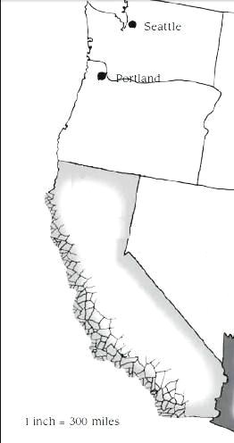
The West Coast
California, Oregon and Washington
Credit goes to Primus on the Palladium Books forum for the following text and ideas
The West Coast of the old American Empire was a cultural and technological haven in the 21st century. The folks of California and Washington especially benefited from the tech booms of the 20th and 21st centuries in many fields including medicine, cybernetics, computers, and military tech while Oregon was a beautiful tourist haven boasting a few small cities but millions of acres of pristine wilderness. Metropolises like San Francisco, Portland, Seattle, and Los Angeles became meccas of education and industry. Many coastal cities built up their port facilities as industry advancements led to more exports. Later, as the new Cold War advanced, military facilities and munitions plants began to pop up more and more, especially in areas like San Diego and Southern California where it was densely populated and the weather was pleasant year round. In addition to the businesses, the coastline was filled with great universities and schools and also was an extremely popular tourist area. Many theme parks, shopping centers, and natural attractions drew millions of people to live and visit the West Coast every year.
Of course, geologically, the entire area was very active; it made up the eastern border of what was known as the “Circle of Fire” around the Pacific Tectonic Plate - a line of faults and active volcanoes that encircled the entire Pacific Ocean. The Circle of Fire ran up the entire west coast of the U.S. and Canada, into Alaska and following the Aleutian Islands into the northeastern tip of Asia heading south again through Japan, the Phillipines, the East Indies, Australia, New Guinea, and the northernmost border of Antarctica and finally running north along the western border of South America. Thousands of active and extinct volcanoes were part of this ring as well as hundreds of fault lines, most notably the infamous San Andreas Faultline and the Haywood Fault. The San Andreas alone caused dozens of small earthquakes in California and the Baja every year. However, since the two huge quakes that occurred in the San Francisco Bay area in the 20th century and the great Haywood quake in the Central Valley region, there had been no major tectonic activity along the San Andreas or virtually anywhere else along the volatile coastline. There was lots of talk about the coastline breaking up and off and many scientists believed it would happen someday, but as civilization flourished on the west coast nothing ever happened.
By the time of the Great Cataclysm, the area that was California, Washington, and Oregon supported over 120 million people and was the cultural heart of the American Empire. Los Angeles, Anaheim, Santa Monica, and San Diego were essentially a giant metroplex of over 40 million people - the largest in the world at the time. San Francisco, San Jose, Vallejo, and Oakland had also merged into a single mega-city surrounding the San Francisco and San Pablo Bays. Despite the urbanization of the California coastline many farms, vineyards, and forests still thrived including the stunning Yosemite National Park, Redwood National Forest, and many others- mostly around the area known as the Central Basin between the Sierra Nevadas in eastern California and the western Coastal Ranges. Essentially the state of California had become self sufficient in and of itself and, at the time of the Cataclysm, there was much talk of California seceding from the American Empire to become an independent country. It may have happened eventually, but it never did; they never got the chance.
The Great Cataclysm hit the West Coast of North America perhaps harder than any other location on the planet. It all began with a dull rumble and a minor earthquake - barely a 3.0 on the Richter scale. People were used to this, so initially people went on with their lives. Unknown to them it was a sign of things to come. Within minutes of the small quake’s end, a sustained earthquake started- weak, but the entire west coast shook for the better part of 15 minutes. The quake finally stopped as news reports began to flood in about some kind of military incident occurring in South America. People stopped in the streets to watch the reports, but barely gave the event a passing thought. After all, this was the American Empire. Then a report came in that people paid very much attention to: the Yellowstone Supervolcano had erupted. People were confused and frightened by this event, not realizing that most of the force of the eruption would be blocked by the Sierra Nevada and Klamath Mountains.
Panic erupted and the streets of the great west coast cities returned to a long-lost legacy of the past as looting, violence, and fear spread like a wave. Without warning, the metroplex of LA vanished in the flash of a mushroom cloud- a nuclear detonation that instantly killed over 20 million people! The instant release of psychic energy tipped the fragile ecosystem of the West Coast off into the danger zone. An earthquake the likes of which had never been seen struck the Coast- experts would eventually recount the quake as exceeding a 9.9 on the Richter scale. The quake was felt in Hawaii, Alaska, New York, and Chile. Buildings toppled. Highways collapsed. Cars collided.
Virtually every one of the dozens of fault lines along the coast instantly became active with a vengeance, as if the very ground were in death spasms. With an unimaginable roar, the San Andreas and Haywood faults split right down the middle just south of San Francisco- near Monterey Bay- and water from the Pacific Ocean flooded into the newly created gap killing hundreds of thousands. The Transverse Mountains near Santa Barbara collapsed completely into the earth and created a new waterway that separated most of Southern California from the rest of the mainland, creating what would eventually be named the Angel Islands in the region where the smoking ruins of Los Angeles lay. In the San Francisco-Oakland area, the entire bay bucked up to the level of dry land for a moment then fell back into the earth. The surrounding areas were flooded as the water rushed out of the bay onto land and then back to the Pacific, killing hundreds of thousands. The worst part of all this was that the cataclysm was just starting.
In Southern California a network of dozens of faultlines in the Mojave Desert activated, tore apart the land, and then collapsed completely eventually forming a new inland sea fed by the Colorado River. Every volcano on the west coast from the Baja to the Alleutians erupted and yet another massive earthquake- one that may have been stronger than the previous one- tore through the land. Lightning raged in the volcanic ash, pyroclastic flows and lava claimed millions more, and fields were burned and buried. As things calmed after the first series of eruptions, the ash from dozens of volcanoes proceeded to bury virtually every city and town; anything that wasn’t destroyed by water or earthquake was buried in up to 120 feet of volcanic ash and rock! The Sierra Nevada Mountains grew immensely- nearly 4,000 feet higher than they had been- as the Pacific Tectonic Plate pushed under the North American plate. The Coastal Ranges and Klamath Mountains also grew to nearly the equivalent of Sierras; these ranges, formerly topping out around 8,000 feet in height, grew to over 12,000 feet tall literally overnight. The sudden increase in height destroyed anything on the slopes, causing avalanches and rock slides. Water from the Pacific flooded into the southern part of the state turning the Baja California into an island completely separate from mainland North America.
Further north in Oregon, Crater Lake’s Mount Mazama- despite not having erupted in hundreds of years- completely blew up! The force of the explosion was tremendous- bigger than anything ever seen on Earth. It seems that the mountain was a long-festering supervolcano of immense power! The heat and shockwave from the blast was a hundred thousand times greater than any thermonuclear device created. In its wake, the blast destroyed the mountain completely and had a blast radius in excess of 220 miles, leveling EVERYTHING- the force of the blast was even enough to level other mountains!! Chunks of rock and lava were shot thousands of miles…some even managed to leave the atmosphere altogether. The water from the lake vaporized and eventually rained down over the entire region and into California, Nevada, Washington, Idaho, and Montana causing some mild flooding locally. Lava bubbled up from the core to fill in the hulking blast crater and millions of tons of ash and rock settled over the cooling magma crust. Eventually, the result was a huge barren flatland of lava and volcanic ash over 200 miles in diameter. Essentially a giant hole was blasted in the Cascade Mountains, Klamath Mountains, and most of Oregon, from the city of Valley Falls all the way to the coastline. Even as far south as Yreka in California the blast leveled buildings and ignited trees. The cities of Eugene, Medford, Ashland, Lebanon, and Cottage Grove were completely leveled by a gigantic pyroclastic flow that radiated out from the center of the blast. Virtually all lakes in the radius were completely evaporated as the landscape was reshaped.
Portland, Salem, Gresham, and Lincoln City were all destroyed as Mount Hood, Mount Ranier, the Three Sisters, Mount St. Helens, and Mount Jefferson erupted, spewing forth noxious gases and pyroclastic flows. Forest fires raged completely out of control from the Pacific Coast to the Columbia Basin. The Willemette River became clogged with ash and soot, cutting off water supplies and making any firefighting extremely difficult. Most nearby cities and towns were buried in up to 200 feet of ash. The state of Oregon- once known for its majestic forests, scenic mountains, and quiet outdoors- was reduced to a scarred, burnt flatland known in the new Earth as Ashfall. This is partially due to the fact that it was mainly the volcanoes that wiped the area clean and partially to the fact that- even now, 300 years later- ash continues to fall on the area from dozens of new micro-volcanoes and vents along the Pacific Coast.
Then the Rifts came.
Compared to the rest of North America, the Pacific Coast suffered very little from Rift activity. A few major ley lines came forth- mainly in California near former population areas- but for the most part the area was devoid of magic energy. The area really didn’t need the ley lines to finish destroying it- nature had already done a more than complete job on its own. Demons, monsters, and other D-Bees appeared into a land that was virtually devoid of life altogether. Most of them realized that there was no quarry here or decided they would not be able to survive in such a harsh environment, and subsequently moved to greener pastures to the north or south. As a result, ley line activity in the area stabilized and demonic activity was largely minimized.
Now, in 110 P.A., California and Oregon are barely recognizable from when they used to be. Oregon has largely remained abandoned by man and D-Bee alike. Forest fires still smolder in some areas, especially further northeast towards the former Washington and Idaho borders as well as in areas surrounding the many active volcanoes and vents in Oregon. The eastern part of the states, aside from an occasional scorched forest and a stray ley line, are largely mountainous joining the Rockies and has remained largely unexplored. The Columbia Plateau is more rugged than ever- most mountains in this area were also affected by the geological forces that heightened the other ranges along the Pacific Coast. Hells Canyon has once again been cut through by a newly reborn and more powerful Snake River; the canyon is much narrower than previously and its sheer cliffs cut downward some 6,000 feet. The water table for the western half of America has been altered by the creation of a New Continental Divide- the line which divides which direction water flows down mountains, either toward the east or toward the west. The New Divide is much higher and further west than the original and has created a third runoff area, located in between the original divide and the New Divide. The New Divide runs along the Sierra Nevadas north through the eastern portion of Oregon and veers back toward the original Divide though Idaho and Montana. Almost all of the new runoff drains into the wider and deeper Colorado River, eventually flowing into the Boiling Sea- formerly the Mojave Desert area- or Banning Bay- a new extension of the Bay of Baja located on the Banning Fault. California, once home to 100 million people, has been completely shattered by the numerous geological forces in the area. Nearly a quarter of the former state’s land is now submerged under new lakes and rivers. Most of the rest has become jagged mountain ranges, uninhabitable by virtually anything. Vast forests cover these mountains. The only truly inhabitable areas are near the Pacific Coast. Southern California was fractured into a half dozen new land masses and the Great Valley has been flooded and now rests under a great inland sea.
Shaking Up the West Coast
The Western Coast of the United States is a geologist’s paradise. The area is replete with what one might term geological events. The region running literally the length of the coast of North America from the Aleutian Islands in Alaska all the way south into Central America is littered with mountain ranges, active and extinct volcanoes, faultlines, and differing landscapes. The West Coast region is home to four tectonic plates: North American, Pacific, Cocos, and Juan de Fuca. A tectonic plate is essentially a giant island of the Earth’s crust that floats on the layer of magma directly beneath it. The locations where these plates contact each other produce enormous pressure, heat, and friction. This energy often creates dramatic changes in the landscape. These connection points often form faultlines- such as the San Andreas and Haywood faults. These faultlines are located where the actual contact between two tectonic plates occurs; the land masses move against each other. In the case of the West Coast, the Pacific plate is slowly moving under the North American plate as well as slowly moving northwest. It is this movement that has created the various mountain ranges on the West Coast- the Rockies, the Coastals, the Sierra Nevadas, the Cascades, etc. On occasion, the pressure of the plates moving against each other creates cracks in the Earth’s crust. Heat, gases, and magma can make their way to the service through these cracks and a volcano is born. There are a wide variety of types of volcanoes; these will be covered a little later.
Faults do not just occur where the plates meet. They can occur in a wide variety of locations, such as the famous New Madrid Fault located in Midwest. Such is the case in California and Oregon as well. The stresses of the tectonic plates have created literally hundreds of small faultlines, covering huge regions of the West Coast. The United States Geological Survey provides ample resources to explore and exploit these for game purposes.
As mentioned before, the tectonic plates move against each other at a very, very slow rate, usually between 1 and 3 cm a year. Occasionally major seismic events can cause larger movements, but these are very rare. When the Great Cataclysm occurred, it wasn’t so much a movement of the tectonic plates but a massive spasm of the entire Earth. There was relatively little actual plate movement but the pressure caused by the spasming- partially induced by the nuclear explosion in the Los Angeles megaplex- was sudden and great. This energy was released in the hundreds of earthquakes and dozens of volcanic eruptions. These sudden releases reshaped the entire region in a matter of moments.
The Mojave Desert had a tremendous concentration of faultlines lacing it. Once the energy releases of the Cataclysm began the dozens of faults in that region activated and began to feed off each other. The constant shaking that occurred caused the entire desert to collapse into the earth, from the Colorado River in the east to the Helendale Fault in the west. The myriad of faultlines continued to feed energy to each other well into the Post Apocalyptic calendar. Over the centuries since the Great Cataclysm the region was fed by runoff from the New Continental Divide and the Colorado River, resulting in a massive lake where the desert used to be, and thanks to the constant shaking of the area- now known as the Quakezone- the waters of the new lake appear to be boiling. Thus was born the Boiling Sea.
The mountain ranges of the West Coast were formed by the transforming border between the North American and Pacific plates- and in small part to the Juan de Fuca plate (located off the coast of Washington and Oregon) and Cocos (located primarily in the Gulf of Baja). It is believed that the ranges were formed when the plates initially collided. One plate was forced under the other. This resulted in the earth being forced upwards, forming mountain ranges. When the plates spasmed during the Cataclysm, these same forces pushed some areas of the region upwards and caused some other regions to collapse. A vast majority of the mountain ranges were bucked upwards into the skies, growing taller by up to 100% in some cases. These ranges included the Klamath Mountains and Cascades in northern California- the region now known as the Highlands-, the Sierra Nevadas, and the majority of the Coastal Ranges. The same forces that bucked these ranges upwards also created counter forces along other faultlines. The Transverse Coastal Range- originally located north of the Santa Barbara Channel- fell victim to the competing forces of the San Gabriel Faultline and Big Sur Faultline. The energies released crushed the Transverse range, creating a subterranean void that the entire range collapsed into. Ocean water rushed in, further aggravating the delicate tectonic balance.
The Great Valley was the central region of California and really the only large region of flatland in the state. Though the region is largely free of major faultlines, the western border of the Valley is replete with them. One might say that, with the Sierra Nevadas on the east and the faults on the west, the region was between a rock and a hard place. When the Cataclysm released the seismic forces that increased the size of the region’s mountains, it affected the Valley as well. Most of the rock and earth beneath the Valley was pushed upwards with the upheaval of the mountains. As a result, the lower levels of earth below the Valley were forcefully evacuated. There was a sudden void beneath a huge portion, causing most of the Great Valley to collapse into the earth. The water runoff from the region’s rivers were aided by the increased sea levels from the reappearance of Atlantis in filling the newly created crater with water; the sea water rushed in through the only real gap in the mountainous circle surrounding the Valley- the chain of bays that began in the former San Francisco area. The end result of these seismic forces was the Great Central Sea- one of the largest fresh water bodies on Rifts Earth.
Finally, there is the most famous feature of Southern California: the San Andreas Fault. A powerful fault, immense potential energy is constantly present along its border. It was this fault that activated the others during the Cataclysm. And it was man that activated the fault. The nuclear blast that vaporized the LA area sent massive shockwaves through the geologically unstable earth. Though San Andreas lays a short distance outside LA, its border absorbed a tremendous amount of the detonation’s energy. This extra energy tipped the balance and caused a tremendous upheaval along the entire length of the fault, from Eureka to Yuma and beyond. This energy was transferred further into the immediate area- as an incredible earthquake, the likes of which hadn’t been seen for millennia. The energy was transferred to surrounding major faultlines- the San Gabriel, the Banning, and the Hayward. The region simply could not take the stress of all the major faults spasming simultaneously. As a result, Southern California shattered, breaking apart into a myriad of islands. The Angel Islands, as they have come to be called, still quake frequently due to proximity to the faultlines-which now rests underwater as the San Andreas Straight, San Gabriel Sea, and Banning’s Pass- and the Quakezone to the east.
As far as the state of Oregon goes, most regional faultlines are located offshore. The damage from any earthquakes in the Oregon area was strictly related to tsunamis along the coastline, but Oregon didn’t need earthquakes to destroy it- Oregon had volcanoes.
Too Hot to Handle
Volcanoes remain one of the most awesome spectacles on the planet. Able to throw clouds of ash miles into the sky, spew forth superheated rock and magma, and destroy large areas of land in an extremely short amount of time. A volcano, by definition, is an opening in the Earth’s (or another planet’s or moon’s) crust that allows the escape of magma, gases, and ash from the mantle, sometimes in explosive fashion. These openings are most common at places where the tectonic plates come in contact with each other or where a plate is expanding (such as in the middle of the Atlantic Plate). The types of volcanoes and their eruptions vary as much as their locations. A wide variety of geologic phenomena are known to often accompany a volcano including geysers, earthquakes, hot springs, and mud pots (heated mud).
- Black Mammoth Mountain, stratovolcano; active; 15,002 feet; located on the Long Valley Caldera about 100 miles northeast of the former location of Fresno. Note that the Caldera is a haven for volcanic activity and Black Mammoth is not the only volcano in the area, just the largest.
- Clear Lake Mountain, stratovolcano; active; 10,235 feet; located in the spot where Clear Lake had been and north of New Haven by 130 miles, the site had been volcanic ages before and reactivated during the Cataclysm.
- Mount Lassen, lava dome, developing to stratovolcano; active; 14,997 feet; located due east of the former site of Redding, CA, by about 50 miles.
- Mount Redding, lava dome, developing to stratovolcano; active; 12,888 feet; located on the former site of Redding, CA.
- Mount Shasta, stratovolcano; active; 17,023 feet; located 100 miles north of Redding, CA.
- Mount Eureka, lava dome, developing to stratovolcano; active; 7,338 feet; located on Eureka Bay in northern California.
- Medicine Lake, shield dome; active; 14,003 feet; located 30 miles northeast of Mount Shasta.
- Ashfall Dome, lava dome; active; 437 feet; located in the center of Ashfall Crater.
- Newberry Volcano and Caldera, shield dome; active; 10,003 feet; 20 miles southeast of the former site of Bend, OR; of note, this volcano had a large collection of cinder cones, vents, and fissures before the Cataclysm, numbering into the dozens so one can assume with the increased volcanic activity post-apocolyptic that continues in the Rifts world.
- The Three Sisters: North Sister, stratovolcano; dormant; 10,230 feet. Middle Sister, stratovolcano; dormant; 10,111 feet; South Sister, stratovolcano; active; 13,774 feet; located 20 miles northeast of Bend, OR.
- Mount Jefferson, stratovolcano; active; 11,855 feet; located north of Three Sisters approximately 20 miles.
- Mount Hood, stratovolcano; active; 13,858 feet; located 50 miles ESE of the former site of Portland, OR.
When you look at a geographic map of Oregon, one thing is easily noticed. All of the populated areas are located in the Willamette Valley between the Coast Range in the west and the Cascades in the central part of the state. The entire state outside of this region is extremely mountainous and rugged. In addition, hundreds of rivers and streams cut through the state to drain melting snow from the mountain peaks. With that amount of water and the presence of volcanoes, the possibility existed of massive mudslides in the case of volcanic eruption or earthquake. This is what happened to the city of Portland. With the eruption of Mount Hood a mere 50 miles away- especially on the scale that it erupted- Portland was hit from both directions. First, the blast itself leveled a good chunk of the city. Second a massive pyroclastic flow rushed from the pulverized mountain into the beleaguered town, crushing all in its wake. Lastly, a flood of melted water, ash, and mud raced down the flanks of both the Cascades and the Coast Range to meet in the middle of downtown Portland. New volcanoes erupting in the Coast Range added their might to that of Mount Hood, producing similar effects. By the time all was said and done, Portland, Salem, and virtually the entire Willamette Valley was buried in hundreds of feet of mud, ash, and debris. Further south, the city of Eugene received a full dose of not one, not two, but FIVE volcanoes; the city never stood a chance. In addition to the eruption of dozens of cinder cone volcanoes in the Newbury Caldera and the blasts from the Three Sisters composite cones, Eugene was also a front line recipient of the full fury of Mount Mazama’s mega-eruption. To have been in Eugene on the day of the Cataclysm was a death sentence. One could look to the east and see the plumes of volcanic eruptions and feel the earth shake, then turn to the south and see a fall of fire, rock, and gas hundreds of feet high roaring at you at a hundred miles per hour- a wall so wide it obscured even the huge 10 mile high ash plume from Mazama’s explosion. So fierce was the blast from that single eruption that NOTHING was left of the city taller than 1 foot. One would never have guessed that there was ever a city there, even if the region wasn’t buried under millions of tons of debris from the Mazama eruption.
The final straw for Oregon was the fact that, since it sits between two large mountain ranges (the Coast Range received the same “shot in the arm” as far as height that the California ranges got from the Cataclysm), any gases that are heavier than air would be trapped in the region. Needless to say, with as many eruptions as were occurring, volcanic gases were plentiful. Those not killed by the eruptions soon had to deal with enormous quantities of poisonous gases such as carbon dioxide, sulfur dioxide, sulfur, hydrogen sulfide, methane, and carbon monoxide. Thousands suffocated to death as these heavier gases displaced the normal oxygen and nitrogen mixture common in the air. These gases still linger in Ashfall to this day, making it one of the deadliest places on the planet.
The rest of the state was decimated by the millions of tons of hot ash that fell from the primary volcanic eruptions and the secondary development of hundreds of micro-volcanoes and volcanic vents that still blast out hot gases and ash 300 years later.
California
On Rifts Earth the former state of California is pretty much divided into five major regions: the Central Sea, the Highlands, New Haven, the Quakezone, and the Angel Islands. We will explore each region one at a time.
The Central Sea
Before the Cataclysm, the Great Valley was one of the few expanses of truly flatland in California. Farms, vineyards, and cities filled the valley. The capital Sacremento was nestled in this valley along with Fresno, San Jose, Redding, Hanford, and Bakersfield. A dozen small rivers flowed into the area from the nearby Sierras. The rivers eventually joined together and poured into a series of small bays before finally reaching the Pacific. The Great Valley by itself was larger than most states, running parallel to the state’s eastern border from northwest to southeast for about 650 miles. It measured over 100 miles across at spots as well. A number of small military facilities were also located in this great expanse including Concord Weapons Station, Lemoore Naval Station, and Camp Roberts. Though relatively free of faultlines, the area was often affected by surrounding quakes. However, that effect would not be as severe as other cities located closer to the Pacific coast. The only “opening” into the Great Valley was through the “line” of bays- Suisson Bay, Grizzly Bay, San Pablo Bay, and San Francisco Bay- that led to the Pacific Ocean. The bays were much like a chain of lakes that led to the Pacific to the west or into the Great Valley to the east.
Very little is left of the Great Valley now. The upheaval of the great earthquakes and reemergence of Atlantis has turned the Great Valley into the Central Sea- an enormous inland sea that measures in excess of 34,000 square miles! The land of the Valley sunk more than 1,000 feet during the geologic upheavals of the Cataclysm, causing water to flood from the Pacific into the Valley. As the Valley sank, the surrounding mountain ranges grew significantly in height; the water runoff from these eventually flushed the salt water out of the Valley, creating what may be the largest fresh water body on Rifts Earth. Much like the rest of the seas and oceans of the world, the Central Sea is a place of strangeness and danger. The northern portion of the lake is haunted by the souls of millions of people who died when the water crashed into the area from the Ocean. Divers searching for relics from the past do so at their own risk. The cities of the Valley were either washed away or completely submerged by water. A number of dangerous demonic predators live in area as well. On the other hand, the water is replete with freshwater fish such as trout, salmon, bass, perch, and walleye. As a result, the few settlements in the area fish the Sea for food. Trees and wildlife have now sprung up along the very slim coastlines. Most settlements are located primarily at the mouth of the Central Sea that drains into the former Suisson, Grizzly, and San Francisco Bays and through the only truly inhabitable areas in the entire region of California and Oregon- a fairly large, flat expanse of land containing the farms, towns, and city of New Haven.
Surrounding the Central Sea are what have become the two largest mountain ranges in North America: the Sierra Nevadas and the Coastal Mountains. 95% of the coast of the Central Sea is made up of steep, sharp cliffs. If not for the size of the Sea, it could have easily been a hidden lake. The cliffs serve to isolate the lake and prevent settlement or land usage. The cliffs average between 500 and 4,000 feet in height and are mostly hard types of volcanic rock and hardened sediment. What little usable shoreline exists is overgrown with lush, thick forests of redwoods and conifers. These magnificent trees grow taller than ever- with some almost reaching the height of the fabled Millenium Trees. These enclaves are some of the region’s few magical places, filled with faerie folk but little else.
The Sierra Nevadas tower over everything in the region, thanks to the massive seismic upheavals of the Cataclysm. These mountains line the eastern border of the Central Sea, from the Klamath Mountains in the north to the Boiling Sea in the south. Before the Cataclysm, these mountains averaged a mere 8,000 to 9,000 feet in height and were easily traversed, being relatively smooth; now they are much more rugged, are prone to avalanches, and are nearly twice as tall! The land area taken up by the range is largely unchanged but they are much more jagged, angled, and severe. Mountain passes are mostly gone and anything that had been on the slopes has been completely leveled. The lands are virtually uninhabitable; nothing grows on the slopes and there are not enough plateaus for construction- the land isn’t stable enough anyways. The only inhabitants of the Sierras now are several types of earth elementals, giants, mountain animals, and dragons. The dragons are especially fond of this area- there are lots of large, hidden caves for them to sleep in.
Only one truly active volcano remains in the Sierras- the Long Valley-Mammoth Caldera’s Mammoth Mountain, now called Black Mammoth Mountain. This mountain is located in about the center of the Sierras and is very close to Central Sea. On the average, it erupts roughly once a month. The longer between eruptions, the more powerful the next one will be (See the section on Volcanoes below). Black Mammoth now resides at a very respectable 15,002 feet in height. The mountain is home to many earth and fire elementals. Elemental Warlocks and Fusionists may travel to the area occasionally but few stay- there isn’t much to survive on.
The second major mountain range around the Central Sea is the Coastal Range. The range lies along the western border of the Central Sea between the Sea and Pacific Ocean. The Coastals are split into the Northern and Southern Ranges by San Francisco/ New Haven Bay; the Northern Range begins south of the Klamath Mountains while the Southern Range ends near the San Andreas Straight. Like the Sierras, the Coastal Ranges virtually doubled in height during all the seismic activity of the Cataclysm; they rose from between 5,000-9,000 feet to between 10,000 and 16,000 feet. These mountains also became more rugged and steep and anything on the slopes has been destroyed. This range also has only one active volcano- Clear Lake Mountain (10,466 feet). Its activity is virtually identical to Black Mammoth, also erupting around once a month. The largest mount of the Coastal Range sits at the mouth of the San Francisco Bay- Haven Mons (15,997 feet). Haven Mons eventually flattens into the only truly inhabitable region in California- a large flat expanse that the city-state of New Haven and its associated communities occupy. Across the Bay to the south is Overlook Mons (14,210 feet) which begins the Southern Coastal Range. From Overlook, one gets an amazing view of the sprawling metropolis of New Haven across the Bay to the north.
New Haven
New Haven is the center of civilization on the West Coast; actually it’s the ONLY sign of civilization on the West Coast. The region itself is the only truly inhabitable area remaining in the state of California- most everything else was completely destroyed or has become far too rugged and mountainous for settlement. The New Haven region surrounds the chain of Bays descending from the Central Sea and proceeds up the coastline. The fertile region surrounding the bays is roughly 1,500 square miles. The city itself has been constructed in the side of a mountain, partially for defense and partially to maximize land usage. The city and suburbs itself take up roughly 250 square miles. The surrounding flatlands are now fertile farmlands, vineyards, and small towns under the jurisdiction and protection of New Haven. What once was a thriving cityscape supporting millions of people during the 22nd century was completely wiped clean or buried under the newly fertile volcanic soil. The city has managed to unearth much pre-Rifts technology from the area and used that to build itself up and thrive. Much technology came from the remains of many military bases in the area as well as from the buried remains of Silicon Valley- the center of the technological world during the Golden Ages. The city-state utilizes a mix of this technology and magic to create a stable and safe environment for many races. It has been termed “Lazlo West” by more than a few adventurers who have managed to survive the wild and dangerous terrain to reach the city. The city proper sits very close to where San Francisco had been. Most of the remains of San Francisco and the surrounding cities were washed away during the brief upheaval that forced the Bay to empty onto land then buried under volcanic ash and dirt washed down from the newly elevated Coastal Range. A large amount salvage was actually discovered in the Bay shortly after the city was founded, composed of remains of buildings, cars, computers, and other equipment. This turned into a huge boon for the fledgling city state. Other excavations resulted in significant technical advances, making the city the only true hope for civilization on the west coast.
The Highlands
Located in the northern part of California, the Highlands are an extremely rugged and mountainous region composed of the northern Coastal Range and the Klamath Mountains. The area is rife with active volcanoes- both new and old- and is virtually devoid of life. Most of the area is nothing but rock outcroppings, pillars of stone, steep cliffs, and narrow canyons. Very little grows here. As soon as something would begin to sprout a volcano would erupt and destroy it. The northern portions of the Highlands start to have a much softer look to them. What appear to be long rolling hills begin to appear the closer one gets to the former Oregon-California state borders. In reality, the hills are mountains, rubble, and the remains of towns all buried in hundreds of feet of ash! One begins to notice that the sky starts to take on a “smokey” appearance to the north and the air has a heavy sulfuric smell to it. These hills serve to separate the Highlands from the area formerly known as Oregon- now called Ashfall. In addition to these ashlands, the northern part of the Highlands borders the huge crater that was formed when the Crater Lake “super” volcano blew. The outer ring of the crater is made up of a debris wall thousands of feet high. This debris field extends a short distance into the Highlands and now, 300 years later, has compacted into a mountainous barrier separating the northern portion of the Highlands from Ashfall.
There are five primary volcanoes in the Highlands: Mount Shasta, Mount Redding, Mount Lassen, Medicine Lake, and Mount Eureka. Mount Shasta stands an impressive 17,023 feet tall now and remains the most famous volcano in the Highlands. Mount Redding, a fairly new volcano, sprung up during the Cataclysm and is among the smallest of the Klamath’s active volcanoes at a “mere” 12,888 feet high. Mount Redding is located just north of where the city of Redding once stood. The town is now buried underneath the mountain that bears its name. Mount Lassen- formerly known as Lassen Peak- is located due east of Mount Redding. This active mount stands at 14,957 feet in height. Medicine Lake is an interesting mountain, to say the least. This volcano marks part of the southernmost blast radius from the destruction of Crater Lake in Oregon. A huge chuck of the northern side of the mountain was sheared away; it remains so to this day. The mountain has begun to rebuild itself from the top down, but most of the northern face is a sheer cliff. It is a remarkable picture indeed, seeing a sheer, blackened cliff face over two miles tall. One can actually see the differing layers that had built up the volcano over the millennia as well as some of the volcanic vents and tunnels dug by nature. Medicine Lake has an overall height of 14,003 feet. Mount Eureka sits on the former site of Eureka, California. Any evidence that there was ever a town there is gone, buried under the 13,238 foot volcano. As with most of the mountainous areas of the west coast, this region has no communities to speak of and little civilization at all. A large number of fire dragons populate the areas around the volcanoes- it may be the single largest population of fire dragons on Earth. They love the volcanoes and often sleep in the many volcanic vents. Several new and unique creatures have also made these torrid peaks their home, but they are few and far between. For the most part, very few creatures will choose to live in the Highlands of their own free will.
Quakezone
The entire West Coast of North America has always been geologically active. Major volcanic eruptions and earthquakes were fairly common along some of the major faultlines in the area. The regional focus had always been on the two major faults- the Haywood fault and the San Andreas fault. These two lines were responsible for majority of the death and property destruction from quakes in the 20th and 21st Centuries. However, literally hundreds of other small faults dot the region. One of the most fault-intensive areas of the state was the Mojave Desert. Located in the southeastern portion near the Arizona border, the Mojave was regularly one of the hottest locations on the planet. The entire southeastern portion of the state of California was completely altered by the Great Cataclysm- maybe more than any other location on Earth, save Atlantis. After the detonation of what was apparently a nuclear warhead in Los Angeles, the tectonic activity altered the water table in southeastern California. Specifically, the size and power of the Colorado River was increased due to the newly created New Continental Divide. All the water from the vast region now drained into the Colorado. In addition, the delicate network of faults underneath the Mojave collapsed completely creating another new inland sea. However this sea and the surrounding areas are under constant duress. Most of the faults in the region are still active on a continuous basis. There are so many faultlines underneath the Mojave region that they constantly activate each other, creating and ongoing chain reaction. Thanks to this, the entire region from the Angel Islands in the west to the Colorado River in the east shakes in one enormous continuous earthquake. Though it is not a major quake by any means, the continuous shaking has made the entire region completely uninhabitable; the quake is basically between a 2.0 and a 3.0 on the Richter scale and is ongoing 24/7/365. In fact, it has several unusual effects on the landscape. First, the inland sea that sits where the Mojave used to be shakes so much that it appears to be boiling- hence the area’s new name: the Boiling Sea. The sea has developed some very unusual wildlife as a result. Second, the continuous shaking has begun to erode the landscape at an accelerated rate. Sinkholes are frequent and most of the region consists of small rubble, sand, and pulverized dirt. The mountains in the regions are granite and extremely solid; however rockfalls, avalanches, and collapses are very common. No plant life exists at all in the region. Anything that tries to grow in the soil is shaken until crushed. Seeds may penetrate into the soil but are eventually crushed under the weight of the ongoing seismic anomaly. The region has cooled considerably as well due to the presence of the Boiling Sea. Rainstorms and flooding are present more often as well as the new height of the surrounding territories traps more of the moisture blowing in off the Pacific Ocean. The rain results in vast muddy plains; however the mud dries quickly as water is actually shaken loose and strained into the ground. The entire region is essentially a barren lifeless wasteland that only elementals could love. The Boiling Sea is home to a fairly large population of water elemental beings of several types. There are no other inhabitants and very few venture into Quakezone, even in emergencies. It is essentially a forbidden area too unstable for use or travel.
The Angel Islands
It had been said many times in the latter half of the 20th century and early 21st centuries that Los Angeles and most of that region would eventually fall into the ocean in The Big One- an epic earthquake along the main faultlines of Southern California. As that infamous quake failed to manifest, Los Angeles grew into a huge megaplex of commerce and tourism. It became one of the richest cities in the American Empire, populated with athletes, movie and vid stars, CEO’s, famous lawyers and politicians, and the like. Home prices in the early 21st century had quadrupled in the region. Underneath it all though ran a ring of corruption; the weak and poor were constantly exploited. It seemed Los Angeles was building up a massive bank of sins that one day would have to be atoned for. That day finally came with the Great Cataclysm.
No city suffered more than Los Angeles when the Cataclysm struck. Once word came of the Yellowstone supervolcano eruption, the city panicked. People began looting, pillaging, killing each other. Then, a terrorist strike of epic proportions: a local religious extremist group, hellbent on punishing the city for its wrongdoings and sinfulness, managed to smuggle a thermonuclear warhead into the downtown area during the confusion. They believed that the Yellowstone eruption was a sign from their God that the time of reckoning was at hand and, in one of life’s great coincidences, they detonated their bomb at the exact same time as Japanese scientists in Hiroshima activated their experimental dimensional teleportation device. Hiroshima disappeared into a pocket dimension; Los Angeles disappeared in another way altogether as a massive mushroom cloud expanded over the downtown region. Over 20 million people were vaporized instantly. The blast wave worked its way through the megaplex, tearing through megasteel buildings like tissue paper and leveling hundreds of thousands of businesses and homes. But the effect it had on the fragile ecosystem was far, far worse. The shockwave from the massive blast helped to loosen the geological locks in the area’s fault lines which led to the massive earthquakes and geological events that followed, as well as finally collapsing large areas of the land and separating the former city from the mainland and shattering it into several large islands. More importantly, the region was instantly charred and leveled, as well as being highly irradiated for many years. The release of psychic energy in such concentration created a super nexus point where downtown LA had been. A series of small, but powerful ley lines intersect the area and rift activity is heavy. The islands themselves are extremely dangerous, not only from the rift and demonic activity but from geological instability. The area rates at least 5 small earthquakes (4.0 or less on the Richter scale lasting 1d6 minutes in length) a day and at least one large earthquake (4.0-6.0 Richter rating lasting 1d6 minutes) a week. On average the area will be crushed with a powerful earthquake (greater than 6.0 Richter rating) once a month. Thanks to the unstable geography, very little grows on the Angel Islands and very few living creatures call them home. The area is mostly populated with ghosts, banshees, and neuron beasts- creatures that do not have legs and don’t require normal nourishment for the most part.
Oregon & Washington
The area that had been the state of Oregon is a vast, smoky wasteland. The terrain is rugged and virtually impassable- in the regions not buried in ash and mud. The northeastern portion of the state- mainly the region of the Colombia Basin- is a jagged, uninhabited area full of thousand foot cliff faces, volcanoes, charred forests, and powerful rivers. As mentioned above, the Snake River has become incredibly powerful; the forces of its waters are powerful enough to crush even the most sturdy mega-damage materials against the sheer cliff walls of the New Devil’s Canyon it has created. The Snake River now feeds into the Colorado River as well, contributing a large amount of runoff and silt to the newly enlarged waterway. The river at this junction is viscous, prone to flooding, and rising continually in its bed as more and more ash and rock is deposited in it. Fires do still burn in the region frequently as a dozen active volcanoes reignite the remains of the Basin’s thick forests. A community or two are scattered in this region at higher altitudes, but nothing one would call civilized- even by Rifts Earth standards.
Ashfall Crater is now the largest natural volcanic formation on the planet. The hole left in the wake of Mt. Mazama’s mega-eruption covers an area of nearly 31,000 square miles and rests a good 400 feet below sea level. When the original eruption occurred the Earth’s crust was blasted nearly a quarter mile deep over the entire area; it was as if some mighty force had simply scooped out the ground. Lava and ash have slowly filled the crater over the course of the last 300 years, packed-in strata of watered down ash, soot, pulverized rock, and liquid rock. The area has increasingly solidified over the years, but still remains uninhabitable; the area is frequently rocked with earthquakes (3d6 per month- strength 2+1d6 on the Richter scale) and has begun to fill with fresh water. At this point only the very center of the blast crater is filled, creating a large, blackened lake. Ash continues to fall throughout the crater and is washed down into the lake; dozens of vents continually kick out thousands of tons of ash a year. Only a couple life forms are able to survive in the soot-stained waters. Ash is constantly in the air, making breathing difficult and clogging intake valves.
Around the entire border of Ashfall Crater as well as scattered everywhere throughout the state (roughly 1d4 every 200 square miles) are so-called microvolcanoes. These small hills are actually vents from the Mount Mazama supervolcano that continually spew forth heated gases, sulfur, methane, ash, and the occasional lava flow. The sheer number of the vents has helped to give the region its name; from the Pacific Coast to the border of Idaho, ash is ALWAYS in the air thanks to these vents. The presence of the vents is both a nuisance and a blessing. Why a blessing? The vents continually blow off pressure from the Mount Hood site, releasing pressure which would otherwise be building up underground, possibly causing future super-eruptions (granted the timeframe is hundreds of thousands of years). The nuisance- ash is EVERYWHERE. In some places the ash is up to 1,000 feet deep, but most areas average 400-500 feet in depth. The ash is virtually impossible to traverse in much the same way as deep snow- one sinks deeply into the ash and may even be unable to climb out. The closest the area gets to being traversable is 1-3 days after a heavy rain. The rain packs the ash down temporarily and might allow for safe movement of man-sized objects- in much the same way that a frozen top layer of snow allows limited passage to lightweight objects. It also can increase the distance that one can see through the constant haze. However, VERY few make the trek; besides the difficulty of the ash, the entire region is thick with sulfur, methane, carbon monoxide, and other volcanic gases. If one does not don environmental armor or a gas mask or filtration unit, the gases will lead to poisoning and death within 2d4 days. The mountains to the east and west serve to hold the gases in the region as well, creating a huge noxious cloud thousands of square miles in size. The air does tend to clear up the higher one gets, usually around 4-6,000 feet above sea level, but the smell lingers for longer. This region has become a haven for fire dragons and elementals. A few other life forms have adapted to the region as well, such as the flatfoot iguana, smokewalker, ashwalker, and sootspitter. The entire region has maybe 3 or 4 ley lines- and weak ones at that. The only one of interest runs along the southeastern corner and connects to a major ley line in both California and Montana. This allows for some limited ley line messaging to the region, but little is done.
